- Home
- Media Center
-
Events
- Wuzhen Summit
- Regional Forums
- Practice Cases of Jointly Building a Community with a Shared Future in Cyberspace
- World Internet Conference Awards for Pioneering Science and Technology
- The Light of Internet Expo
- Straight to Wuzhen Competition
- Global Youth Leadership Program
- WIC Distinguished Contribution Award
- Membership
- Research & Cooperation
- Digital Academy
-
Reports
- Collection of cases on Jointly Building a Community with a Shared Future in Cyberspace
- Collection of Shortlisted Achievements of World Internet Conference Awards for Pioneering Science and Technology
- Reports on Artificial Intelligence
- Reports on Cross—Border E—Commerce
- Reports on Data
- Outcomes of Think Tank Cooperation Program
- Series on Sovereignty in Cyberspace Theory and Practice
- Other Achievements
- About WIC
- 中文 | EN

Chinese engineers make sci-fi drone mapping reality

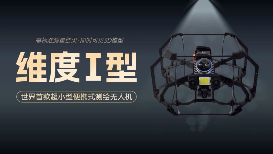
The Center for Spatiotemporal AI Perception Technology at Tianfu Jiangxi Laboratory in Chengdu, Sichuan province, recently launched Dimension 1, a drone that performs asset digitization scanning tasks in indoor environments. [Photo provided to chinadaily.com.cn]
A scene from the science fiction film Prometheus, where explorers deploy a mini-drone that laser-scans caves to generate 3D models instantly, has turned into reality, thanks to the efforts of Chinese engineers.
On Tuesday, the Spatiotemporal AI Perception Technology Innovation Center at the Tianfu Jiangxi Laboratory in Chengdu, Sichuan province, announced that it has launched Dimension 1, the world's first ultra-compact portable mapping drone. It is designed to perform asset digitization scanning tasks in indoor environments.

The World Internet Conference (WIC) was established as an international organization on July 12, 2022, headquartered in Beijing, China. It was jointly initiated by Global System for Mobile Communication Association (GSMA), National Computer Network Emergency Response Technical Team/Coordination Center of China (CNCERT), China Internet Network Information Center (CNNIC), Alibaba Group, Tencent, and Zhijiang Lab.


